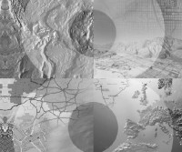
Uncertainty in Remote Sensing and GIS
Giles M. Foody, Peter M. AtkinsonThis book provides general overviews on uncertainty in remote sensing and GIS that illustrate the range of uncertainties that may occur, in addition to describing the means of measuring uncertainty and the impacts of uncertainty on analyses and interpretations made.
Uncertainty in Remote Sensing and GIS provides readers with comprehensive coverage of this largely undocumented subject:
- Relevant to a broad variety of disciplines including geography, environmental science, electrical engineering and statistics
- Covers range of material from base overviews to specific applications
- Focuses on issues connected with uncertainty at various points along typical data analysis chains used in remote sensing and GIS
Written by an international team of researchers drawn from a variety of disciplines, Uncertainty in Remote Sensing and GIS provides focussed discussions on topics of considerable importance to a broad research and user community. The book is invaluable reading for researchers, advanced students and practitioners who want to understand the nature of uncertainty in remote sensing and GIS, its limitations and methods of accommodating it.
 Amazon
  Barnes & Noble
  Bookshop.org
  File converter
 Više rezultata pretrage
 More benefits


Najčešći pojmovi
Povezani Spiskovi knjiga